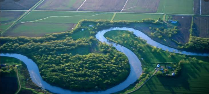
It is shorter than the Shabelle River in terms of length, as it reaches about 1030 miles from its sources, between latitudes 4 and 8 degrees north of the equator, but it is of greater benefit in terms of using its waters for irrigation.
The Juba River has three main tributaries: Webi Giestro, Down Payama Valley, and Doria Valley, which is the meeting point of the Somali border with Abyssinia in the modern era.
The river flows after the town of Dolo, but the descent is slow, and the speed of the river is weak. At the town of Bardera, the strength of the river in the flow increases because of the side extensions of the gorges that connect to the river during the flood. The most important of these tributaries are the Hereik Stream and the Iae Dese Stream, which comes from the hills of the Anfadi region, and its length is about twenty kilometers, and it is one of the most important tributaries of the Juba River due to its abundance of water and its extreme depth, making it suitable for navigation for small ships.
The waters of the Juba River end to the sea (north of the city of Kismayo), and the largest extent of the Juba Valley reaches 250 km.
The Juba River has two floods, one of them in the fall, which is abundant in water, and it starts from April to September, and the average river discharge is between 800 to 1000 cubic meters per second, and the second flood is less than the first, and usually begins with the end of September and October, and the water decreases In late January, February and March, the water in that river seldom dries up.
In the winter, which is the dry season, the river discharge averages between 15-20 cubic meters per second, and we note that the waters of the Juba River are less salty than the waters of the Shabelle River, so most agricultural lands and agricultural expansion projects are consistent with the Juba River.


.webp)


No comments:
Post a Comment